Cape Town: The Information Systems and Technology (IS&T) Department is set to launch a redesigned City of Cape Town MapViewer on Thursday, April 30, 2026. This updated digital tool has been programmed to provide residents, businesses and professionals with a cleaner, smarter and more intuitive mapping experience of Cape Town.
Member of the Mayoral Committee for Corporate Services – Alderman Theresa Uys stated that as Cape Town continues to embrace digital transformation, the new City of Cape Town MapViewer will serve as a centralised hub for critical spatial data, making it easier than ever to visualise the heartbeat of the City.
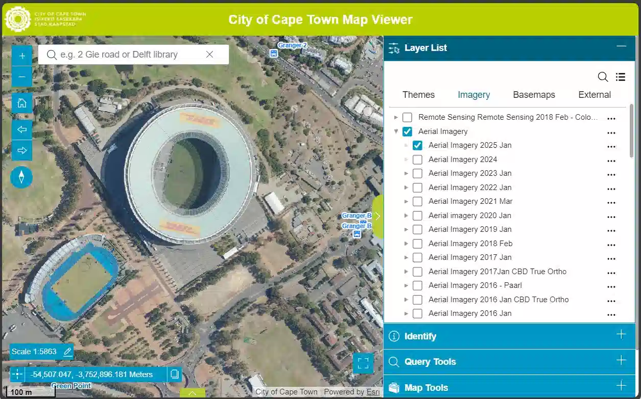
As per the sources, the department has redesigned City of Cape Town MapViewer that focuses completely on user efficiency and clarity. It features several key upgrades, such as:
- Expanded Screen Space: A minimised interface that allows users to focus on the map without distractions.
- Streamlined Navigation: The Table of Contents is now neatly organised within a dedicated right-hand panel for quicker access to data layers.
- Categorised Imagery: All imagery sets are now grouped logically, allowing users to toggle between different historical and aerial views effortlessly.
- Custom Print Scaling: Professional users can now set specific custom scales when generating digital maps for printing.
Considering this, Alderman Theresa Uys stated that the new viewer is a vital resource for a diverse range of users. It includes urban planners, engineers, estate agents and academics.
However, it is equally valuable for everyday residents who need to access place-based information quickly, added Alderman Uys.
According to the MMC for Corporate Services, the users can instantly locate property details, access planning and environment information, identify utility services, locate the nearest public facilities, view ward boundaries and can vote districts as well as pinpoint locations for service requests such as potholes, illegal dumping or water leaks.
It was important for the City of Cape Town to launch this MapViewer, as its redesigned version offers a cleaner, smarter and more user-friendly way or method to explore spatial information across the metro.