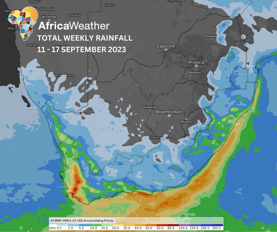
Africa: Africa Weather Forecast launched their climate summary in which they reported that the weak is a major cold front is marching east, precipitating light showers along the coastal provinces, light snow over the Cape mountains and strong winds over the Cape interior between Monday and Tuesday. This will be followed by clear skies midweek until Thursday when a less intense cold front initiates light rainfall in the far southwest and strong winds over the Cape interior.
MONDAY: Cloudy, windy and wet across most of the country with a high chance of light rainfall, mainly along the coastal regions of Western Cape, Eastern Cape and KwaZulu-Natal, intruding onto the interior over the eastern provinces later in the day. Medium chance of light snow over the Western Cape and Eastern Cape’s mountainous/northern regions, while winds will most certainly influence most of the country at varying above-normal intensities except for Limpopo.
TUESDAY: Much calmer in the west and central interior but partly cloudy in the east with morning fog patches creeping up the Lowveld and a medium chance of light snow along Lesotho’s eastern border with KwaZulu-Natal. Passage of this cold front brings a significant airmass change, dropping temperatures across the country, especially in the morning with frost expected in the south, while cool in the east with strong easterly winds in northern Limpopo.
WEDNESDAY AND THURSDAY: Very strong winds are highly anticipated on both days over the Cape interior, peaking at speeds between 40-60km/h as a cold front approaches with the promise of light rainfall in the southwest on Thursday evening, leaving Wednesday and most of Thursday, predominantly fine and warm.
FRIDAY: Overnight showers from the cold front will most likely spread into more of the Western Cape throughout the day as strong winds once again resurface over the southern Cape interior. Otherwise, fine and warm elsewhere.
THE WEEKEND: As it moves east, the cold front will spread its influence into the southern parts of the Cape interior, bringing light rainfall into the Western Cape, coastal Eastern Cape and coastal KwaZulu-Natal on Saturday but mainly in the east and far south coast on Sunday, indicating the cold front’s disintegration. It also brings strong winds over the Cape interior on Saturday but slightly less so on Sunday.

