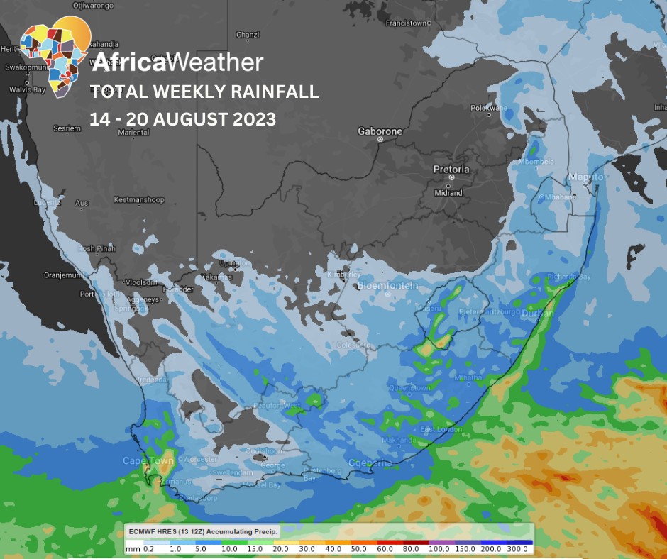
Africa: Africa Weather Forecast launched their climate summary in which they reported that the weak cold front in the south will be a high-pressure cell ridging along the coast most of the week, resulting in partly cloudy, cold and wet conditions over the coastal provinces from Tuesday, shifting east midweek and later.
Intermittent showers are expected over coastal provinces most of the week while strong winds batter Northern Cape’s interior on Wednesday, central parts on Thursday and the eastern Highveld on Friday.
Cloudy in the south with a high chance of light showers over the Western Cape and Eastern Cape and strong NW winds over the central interior (central Free State and North West ), but low over the eastern Northern Cape. Otherwise, very low chance of isolated thunderstorms with light rainfall in and around Lesotho during the day.
Although Tuesday’s winds may be less intense and slightly east than Mondays, they may still be disruptive for certain wind-sensitive operations over eastern North West, eastern Free State and southern Gauteng. Otherwise, partly cloudy and cool with a high chance of light morning rainfall along the south coast, the Eastern Cape and southern and eastern KwaZulu-Natal but fine and warm elsewhere.
By Wednesday, continuously clear skies will be accompanied by increasingly warmer temperatures across the country whilst the east becomes cloudier with a high chance of morning fog and light rainfall over north-eastern KwaZulu-Natal and the Lowveld. High chance of strong NW winds around midday, followed by a few storms overnight in places over the central Northern Cape.
On Thursday, overnight showers will become morning thundershowers over the Cape interior, spreading southeast into Eastern Cape and southern Free State during the day. Otherwise, fine and warm, Except for the southwest, where there is a high chance of light rainfall from midday onwards. High chance of strong N-NW winds over the central interior.
Fine and warm over most of the country on Friday but becoming partly cloudy in the southeast with a medium chance of isolated afternoon thunderstorms in southern KwaZulu-Natal and eastern Eastern Cape, while in the southwest, light rainfall is expected in the first part of the day.
This clear sky trend will persist throughout the weekend in the north and northeast with a high chance of widespread showers, and thundershowers focused on the Eastern Cape but isolated in neighbouring provinces on Saturday. Light rainfall is expected in the far southwest and southeast on Sunday. There is also a high chance of strong NW winds in places over the Cape interior on both days but stronger on Saturday.