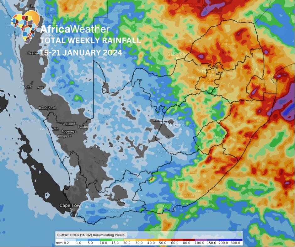
Africa: The Africa Weather Forecast has predicted extreme weather conditions for South Africa from the coming week from January 15th to January 21st.
It is forecasted that there will be a wide and well-developed upper-air low is expected to expedite generous rainfall amounts over the central and eastern regions between Wednesday, Thursday and Friday, following a period of light rainfall in the east at first and much later in the week, resulting in consistent rain in places in the east, throughout the week.
MONDAY AND TUESDAY: High chance of light rainfall in the far east on Monday (KwaZulu-Natal, Eastern Cape and parts of Limpopo) but over more of the Highveld and areas to the east and southeast of the Highveld on Tuesday.
This, as a steep trough, develops into a closed upper-air low with the potential for extensive rainfall, strong winds and hail for the rest of the week. Otherwise, fine and warm to hot in the west for the first two days of the week. High chance of strong W-SW winds over the Cape interior on Tuesday.
WEDNESDAY, THURSDAY, AND FRIDAY: Intensification of the upper-air low in the west results in a high chance of widespread, persistent showers and thundershowers over the central and eastern interior on Wednesday and Thursday but shrinking towards the east while also becoming very light on Friday.
Persistent showers and thundershowers may lead to flooding in places in the east, such as KwaZulu-Natal, eastern Eastern Cape, and eastern Mpumalanga, on Wednesday but in the northeast on Thursday and becoming dichotomous with light showers in the far northeast, particularly Limpopo but also in the far west, especially central Northern Cape on Friday.
SATURDAY AND SUNDAY: The system is expected to pull most moisture westwards on Saturday but allow it to shift towards the central interior and southeast on Sunday, meaning the east will become partly cloudy-to-fine and warm to hot throughout the weekend following a few cloudy and wet days during the week.