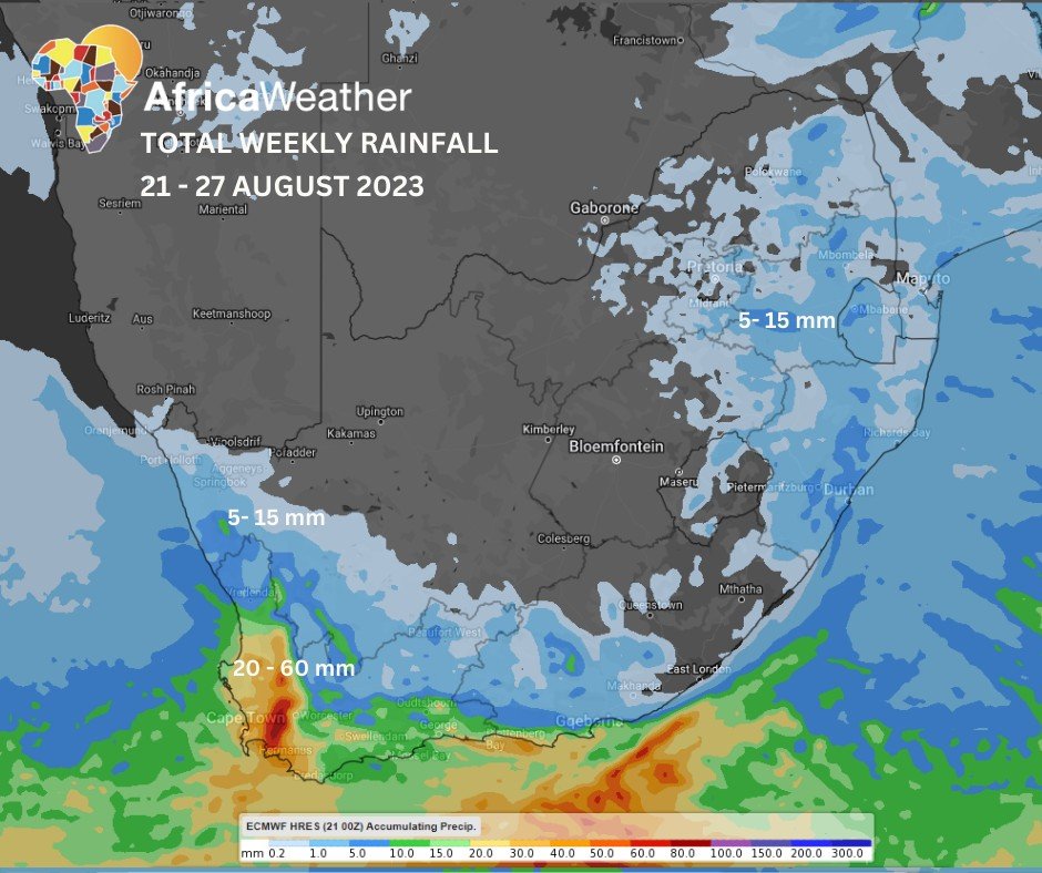
Africa: Africa Weather Forecast launched their climate summary in which they reported that the weak cold front, moving into the southwest today and tomorrow, promises light to moderate rainfall for the Western Cape, with bouts of strong winds across the Cape interior, the south coast, southwest coast and the eastern Highveld. Moreover, high seas along the Western Cape’s coastline are also highly probable.
On the flip side, expect warmer temperatures and clear skies over the interior for most of the week, barring the coastal zones where sporadic cloudiness might lead to light showers along the east coast later in the week but for most of the week on the south and southwestern regions.
Monday: A high chance of moderate rainfall in the far southwest (close to Cape Town), while light showers are expected later today elsewhere along the west coast and the rest of Western Cape. Otherwise, anticipate fine and warm conditions, though the northeast (Limpopo) will swelter in hotter temperatures, while the southern Cape and Highveld will encounter gusty winds.
Tuesday and Wednesday: As the cold front ventures eastward, partly cloudy skies shroud the east coast, with very light rainfall expected on Wednesday evening near Durban. Simultaneously, a secondary wave will sprinkle intermittent showers across the southwest and south coast.
Despite these variations, a sense of calm prevails for most regions, while the eastern Highveld and southern Cape continue to experience brisk winds reaching 50km/h over the Western Cape interior near Laingsburg but stronger closer to Western Cape’s coastline on Tuesday but the south coast on Wednesday.
Thursday: There is a very low chance of isolated storms hanging over North West and Gauteng but medium over the eastern escarpment with light rainfall over KwaZulu-Natal. Mostly fair and warm conditions elsewhere, but cool in the south.
Friday and Saturday: Throughout Friday and Saturday, anticipate a medium chance of isolated showers and thundershowers, particularly in the eastern regions, and a high chance of light rainfall in the southwest.
These weather phenomena will gradually shift eastward, storms encompassing the northeastern areas on Saturday, while the south and southeast will most likely be covered by light rainfall on Saturday. High chance of strong NW winds gusting between 30-50km/h over the interior and 60-70km/h along the south coast on Friday. Medium chance of light snowfall along the southern Drakensberg on Friday afternoon and into Saturday.
Sunday is likely to mark the commencement of an extended spell of dry, clear skies. Partly cloudy in the east at first.

